Leading Utilities & Service Companies Trust UAV Recon to Ensure Grid Reliability


UAV Recon Has You Covered
From flight to final report
Pilots With Industry Expertise
Anyone can fly a drone, but few people really understand aerial operations. UAV Recon Pilots are trained to the highest level of safety and operational efficiency. Our Chief Pilot is a 15-year U.S. Air Force Veteran with 4,200+ flight hours. He is a certified part 107 pilot and a thermographer. He has leadership and management experience, leading large and small teams to success in and out of the field.
.jpg)
Data Capture
Transmission & Distribution
(4kV to 345+kV)
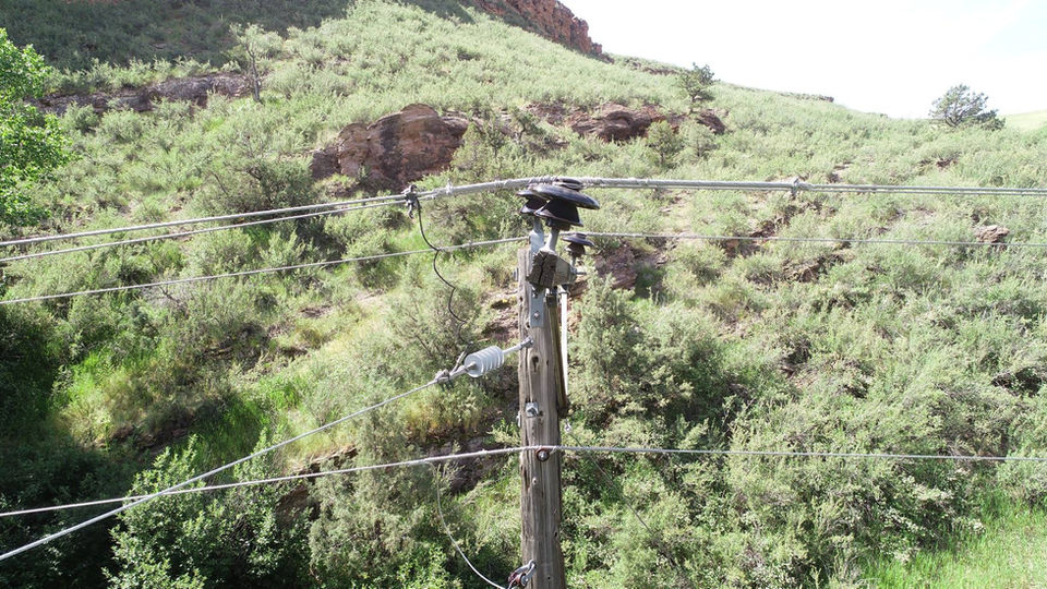
From the smallest distribution lines through interstate transmission structures, UAV Recon uses advanced technology to capture high-resolution visual data around components, structures and vegetation encroachment. Standard service offerings include a camera quality of 20 Megapixels and 4K videos with a 77° Field Of View.
Thermal Data Capture
& Substations
(Customer, Distribution & System-level)
UAV Recon capabilities include thermal sensing for condition monitoring and predictive maintenance. Our certified electrical thermographers deliver inspections that meet ANSI/ASNT CP-105 and CP-189. UAV Recon is also licensed to fly at night.
.jpg)
Validated Analysis & Inspection
100+ Certified Journeymen Linemen
UAV Recon's network of certified journeymen linemen has expertise across electrical lines from 4kV to 345+kV. From structure damage to component-level wear and tear, our linemen identify & diagnose defects for criticality & repair requirements including parts and labor hours.
Natural Disaster: Rapid Response
During natural disasters, response time is critical. Traditional data capture and inspection methods fail to provide stakeholders with immediate actionable data. While faster than ground-based data collection, traditional UAV-based inspection requires post-processing that can take hours or even days. For that reason, UAV Recon is a certified enterprise-level NAR customer. With NAR, UAV Recon delivers real-time natural disaster & damage assessment reports. In recent flooding events, UAV Recon delivered assessment reports in under 30 minutes.
Reporting Dashboard
Managing and hosting tens of thousands of drone images is a complex task. UAV Recon leverages VOLT software to securely organize, host and share data seamlessly including inspection reports, advisories, bill of materials (BOM), criticality rating, labor hours and cost estimates.
World Class GIS Integration Services


Flying Drones Yourself? Check the tools we use to inspect 100+ poles a day and generate real-time natural disaster reports
UAV Recon by the Numbers
.png)
70K+
Structures Inspected
.png)
0.5M+
Images Processed

45+
Years of Experience
.png)
100%
Safety Record
UAV Recon Footprint

Not Enough Time or Linemen to Get All of Your Inspections Completed?
Get started with our guide
.png)
In this guide you will learn about:
-
Benefits of drones/UAVs
-
Drones vs traditional data collection options
-
Cooperatives & Municipalities using Drones
-
Safety and the Value of Experienced Pilots
-
Special Offers and more
Utilities and Private Customers Across the USA trust UAV Recon
"I am a former lineman of 12 years and I’ve personally seen the value... UAV Recon allows you to inspect lines with as little exposure as possible to your employees or customers... [their] pilots fly the line and upload the images... [then] make it useful to the utility via the largest network of journeyman inspectors in the country."
"We flew 268 miles of our 69kV backbone and that was turned around in 10 days, it is crazy fast. That sort of time certainly justifies the expense and is very cost-effective, far more cost-effective than we could do with our own resources."
Jason F., Certified Journeymen Linemen
Curtis K., General Manager - Southwest Public Power District
"The amount of work that was produced… especially during this pandemic, was truly impressive. The project was a success and the information we gained from it is invaluable."
"Our utility and engineering clients have been very satisfied with the high quality of your analysis and reporting. Your team is easy to work with and delivers actionable data fast."
Don C., President Air Data Solutions
Roger G., COO, Gunnison County Electric Association
Data Samples
Meet The Team

Greg Blevins
President
Greg is a visionary leader and entrepreneur serving the energy sector for over 42 years. An entrepreneur, co-founding and launching several successful advanced technology businesses. UAS systems and services, digitizing and analytical software, and leading-edge processes that are at the forefront of multiple energy sectors including renewables.

Charlie El Khoury
Director of Marketing
Charlie has been building drone systems and inspection software applications for 7+ years. He was co-founder & CEO of NAR, the 1st
real-time drone data management and reporting app for infrastructure inspection. He leads product development and marketing initiatives.
.jpg)
Keith Carter
Operations Manager
Keith is a 15-year USAF Veteran, a certified level one thermographer, and an FAA Part 107 Remote Pilot with over 4,200 flight hours. He has leadership and management experience, leading large and small teams to success in and out of the field. He is a leader in training, customer relations, project, and program management.
Book a Trial
Flying Drones Yourself?
Automate Your Data Management & Analysis with VOLT
Drones generate tons of data. UAV Recon uses VOLT software and on-demand linemen to rapidly inspect images and complex structures. Typical VOLT reports contain advisories, locations, repair recommendations, costs & Bill of Material (BOM). With 2M+ images processed, VOLT is the most efficient data management and analysis option for turnkey electrical infrastructure inspection. You can use VOLT too! (UAV Recon is an authorized re-seller and trainer for VOLT software.)


Deliver Real-Time Natural Disaster & Damage Assessment Reports with NAR
In emergency response situations, time is critical. Drones are fast, but unfortunately traditional drone data management & reporting tools can require days of processing. NAR is the first drone application that enables real-time natural disaster and damage assessment reports – as soon as the drone lands. Internationally recognized for excellence, NAR is the global standard for real-time emergency assessment and reporting. Now you can use NAR too! (UAV Recon is an authorized re-seller and trainer for NAR drone software.)


